
Monthly archive series: May 2024. Written and first published in October 2026.
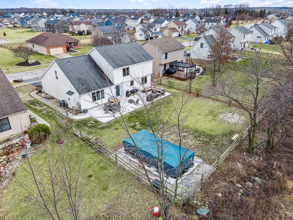
Aerial photography is most useful when height answers a question that ground-level images cannot. It might explain the relationship between a house and its outbuildings, the arrangement of a larger site or the setting around a property. A drone photograph adds less when it simply repeats the front elevation from farther away.
Before adding aerials to a listing, write down the question you want the images to answer. That brief gives the photographer a practical goal and helps you decide whether the service belongs in the media plan for this particular property.
Look for a question about the site
Useful aerial subjects include a long approach, separate buildings, outdoor recreation areas and the relationship between a structure and surrounding land. For a commercial property, the arrangement of parking, entrances and service areas may matter. For a house, a rear yard or unusual site shape may be hard to explain from the street.
Describe the feature specifically. “Show how the detached garage connects to the driveway” is a clearer request than “get something impressive.” Aerial images can support that explanation, while ground-level photographs show the detail and condition of the structures themselves.
Use more than a straight-down view when needed
An overhead image can reveal arrangement, but it may make buildings difficult to recognize. An angled view can show the house and setting together. Which approach is useful depends on the property and what the viewer needs to understand.
Do not request a large number of aerial images simply because the aircraft is available. A few distinct views may explain the site better than a gallery of similar perspectives. Plan for each selected photograph to contribute something: arrival, building relationships, outdoor space or broader setting.
Keep boundaries and proximity claims separate
A photograph is not a survey. Fence lines, mowing patterns and trees do not establish legal property boundaries. If a marketing graphic includes an outline, have the listing professional verify the source information and make its illustrative nature clear. Do not ask the photographer to infer a boundary from appearance.
The same care applies to nearby destinations. A visible park, water feature or road should not be described as part of the property unless that is verified. Labels such as nearby or shared may be necessary. Avoid unsupported claims about travel time, access rights or future development based on what can be seen from the air.
Discuss the address before promising the shoot
Airspace and site conditions can affect whether and how aerial capture can proceed. The FAA explains that operations in controlled airspace may require authorization. Give the operator the exact location early and let the qualified pilot assess the flight requirements.
Weather, people, obstacles and safe access also matter. A booking should not be treated as a guarantee that every requested view can be captured on demand. Discuss a backup approach, such as completing the interior work while an exterior decision is made, without assuming that a separate visit is included at no additional cost.
Prepare what the aircraft may see
Aerial coverage can reveal areas hidden from the street. Store loose materials, move vehicles as agreed and check the rear yard, side yards and outdoor living spaces. Keep permanent conditions visible. Tell the photographer about areas that cannot be accessed or prepared rather than trying to conceal them in a misleading way.
Review the TREM419 aerial photography offering alongside the rest of the media plan. If the main question is interior circulation, a floor plan or tour may be the more useful addition. If the question is how the property sits on its site, aerial photography may provide the missing context. Choose the service that answers the question, then give it a clear role in the final listing.
Photograph from the TREM419 property media library, used to illustrate this guide.